Geografie / Geographie / geography

44950BB.jpg

Rosenbusch, Die donau von Passau bis zur ungarischen Pforte.

€ 150,-- 

Rosenbusch, Werner: Die Donau von Passau bis zur ungarischen Pforte. Eine Folge von 90 Federzeichnungen. 2 Teile (komplett). 1. Teil: Von Passau bis Schwallenbach. 2. Teil:Von Schwallenbach bis zur ungarischen Pforte. Ulm, R+P Reproduktionsgesellschaft, 1989. Folio. 41 x 41 cm. Unpaginiert. 90 Blatt. Original-Klappenbroschur im Original-Pappschuber.

10183EB.jpg

Diesterweg, Lehrbuch der mathematischen Geographie und populären Himmelskunde.

€ 150,-- 

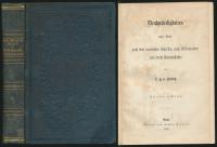
Diesterweg, F. A. W.: Lehrbuch der mathematischen Geographie und populären Himmelskunde. Zum Schulgebrauch und Selbstunterricht. Mit 41 lithographirten Figuren. Berlin, Verlag von Theod. Chr. Fried. Enslin, 1840. 8°. 21 x 13,5 cm. XII, 208 Seiten und V Tafeln. Privater Pappband mit rotem Farbschnitt.

2467FB.jpg

Lewis, A topographical Dictionary of Ireland.

€ 160,-- 

Lewis, Samuel: A topographical Dictionary of Ireland. Comprising the Counties, Cities, Boroughs, Corporate, Market, and Post Towns, Parisches and Villages with historical and statistical descriptions. Embellished with Engravings of the Arms of the Cities, Bishopricks, Corporate Towns, and Boroughs; and of the Seals of the several Municipal Corporations: With an Appendix, describing the electoral Boundaries of the several Boroughs, as defined by the Act od the 2d & 3d of William IV. In Two Volumes. Band 3: Atlas of Ireland. 3 Bände (komplett). Galway, Kenny’s Bookshop, 1995. 4°. 31 x 25 cm. LXVIII, 675 und 737 Seiten, [35] Blatt. Original-Leinenbände mit goldgeprägten Deckel- und Rückentiteln im Original-Pappschuber.

55175BB.jpg

Hopkins, Canada. An Encyclopaedia of The Country. 6 volumes (with supplementary)

€ 180,-- 

Hopkins, J. Castell [Editor]: Canada. An Encyclopaedia of The Country. The Canadian Dominion considered in its historic relations, its natural resources, its material progress, and its national development. Illustrated. Edited by J. Castell Hopkins. In five volumes. 6 Volumes (complete with supplementary). Toronto, The Linscott Publishing Company, 1898-1900. 4°. 28,5 cm. 540, 564, 525, 544, 542 und 556 Seiten. Blaue illustrierte Original-Leinenbände mit goldgeprägtem Rücken- und Deckeltitel.

45496BB.jpg

Sperander, Einleitung Zur Neuesten Geographie von Europa. Köln, 1716.

€ 280,-- 

Sperander [Gladov, Friedrich ?]: Einleitung Zur Neuesten Geographie von Europa, Und Was mit demselben in denen übrigen Welt-Theilen eine Verknüpfung haben möchte. Zur Erkaentnis des Staats von Europa, Der Jugend zum Besten entworffen Von Giovanni Horrico Sperandri. Cölln, [Nürnberg], Bey Peter Marteau, [Johann Hofmann Erben], 1716. 8°. 18,5 cm. Frontispiz, Titel in Schwarz und Rot, 4 Blatt, 422 Seiten, 39 Blatt Register. Pergamentband der Zeit.

Zintgraff, Nord-Kamerun. Berlin, 1895.

€ 280,-- 

Zintgraff, Eugen: Nord-Kamerun. Schilderung der im Auftrage des Auswärtigen Amtes zur Erschließung des nördlichen Hinterlandes von Kamerun während der Jahre 1886 – 1892 unternommenen Reisen von Eugen Zintgraff. Mit 16 Illustrationen und 1 Karte. Berlin, Verlag von Gebrüder Paetel, 1895. Groß-8°. 23 cm. VI, 467 Seiten. 1 Karte. Neuer hellgrüner Leinenband mit aufgeklebtem Rückenschildchen.

51526CB.jpg

Finden, The ports, harbours, watering-places, and coast scenery of Great Britain

€ 350,-- 

Finden, William: The ports, harbours, watering-places, and coast scenery of Great Britain. (2 Bände). Illustrated by views taken on the spot, by W.H. Bartlett; with descriptions by William Beattie, M.D. London, G. Virtue, 1842. 4°. 28 cm. 190, 155 Seiten. Halblederbände mit goldgeprägtem Rückentitel und marmorierten Deckelbezügen.

13753DB.jpg

S.B.M.F.C.L.D.: Diccionario Geografico Universal. Tomo I-X. Barcelona, 1830.

€ 350,-- 

S.B.M.F.C.L.D.: Diccionario Geografico Universal. Dedicado a la Reina Nuestra Senora. Redactado de los mas recientes y acreditados Diccionarios de Europa, particularmente Espanoles, Franceses, Ingleses y Alemanes. Por una Sociedad de Literatos: S.B.M.F.C.L.D. Tomo I-X. Barcelona, Imprenta de Jose Torner, 1830-1836. Groß-8°. 24,5 x 16,5 cm. LXXXII, 874, 1299, 945, 1013, 935, 939, 960, 957, 963, 1236 Seiten. Braune Ganzlederbände der Zeit mit goldgeprägten Rückentiteln, Rundum-Gelbschnitt.

51429CB.jpg

Zannoni, Atlas géographique et militaire ou Théatre de la Guerre. Paris, 1762.

€ 380,-- 

Zannoni, Rizzi: Atlas géographique et militaire ou Théatre de la Guerre presente en Allemagne ou sont marqués les marches et campements des armées, depuis l’entrée des trouppes Prussiennes en Saxe en Aoust 1756. Jusqu’au commencement de 1762 Paris, Ballard, [ca. 1762]. 12°. 13 cm. [39] Blatt. Lederband mit goldgeprägtem Rückentitel.

13755DB.jpg

Guthrie, Nouvelle geographie universelle. Paris, 1802.

€ 380,-- 

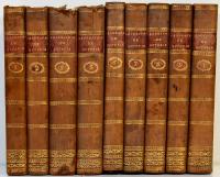
Guthrie, William: Nouvelle geographie universelle. Descriptive, historique, industrielle et commerciale, des quatre parties du monde; ouvrage traduit de l’anglais par Fr. Noel. Les parties Astronom. et cosmograp. ont ete entierement revues et corriges par J. Lalande. Nouvelle édition française. Tome 1-6 (9 livres, complet). Paris, Chez hyacinthe Langlois, 1802. 8°. 20 x 13,5 cm. CXLV, 429, 466, 447, 510, 574 und 598 Seiten. Braune Ganzlederbände der Zeit mit goldgeprägtem Rückentiteln auf roten Lederschildchen.
Konfigurationsbox öffnen
Nach oben